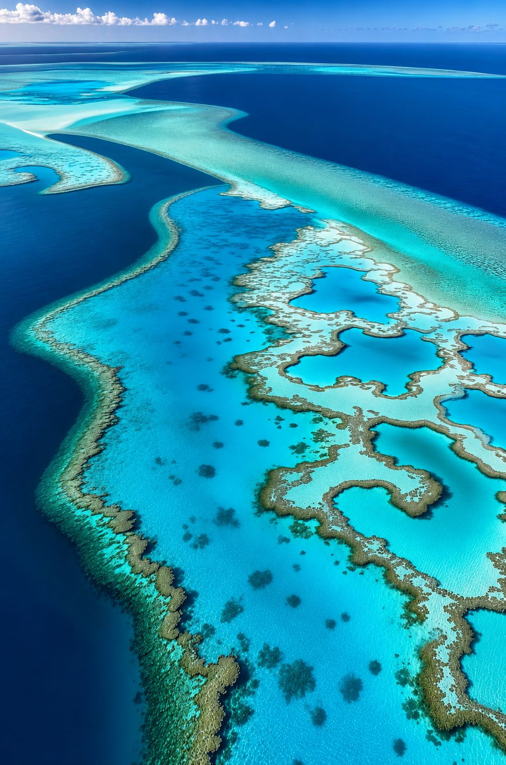
Between the Pacific and the Indian Ocean lies a stretch of sea with more coral species than anywhere else on Earth. Scientists call it the Coral Triangle. Indonesia holds the largest part of it, and these eight maps show what makes it special and what threatens it.
A sea shared by six countries
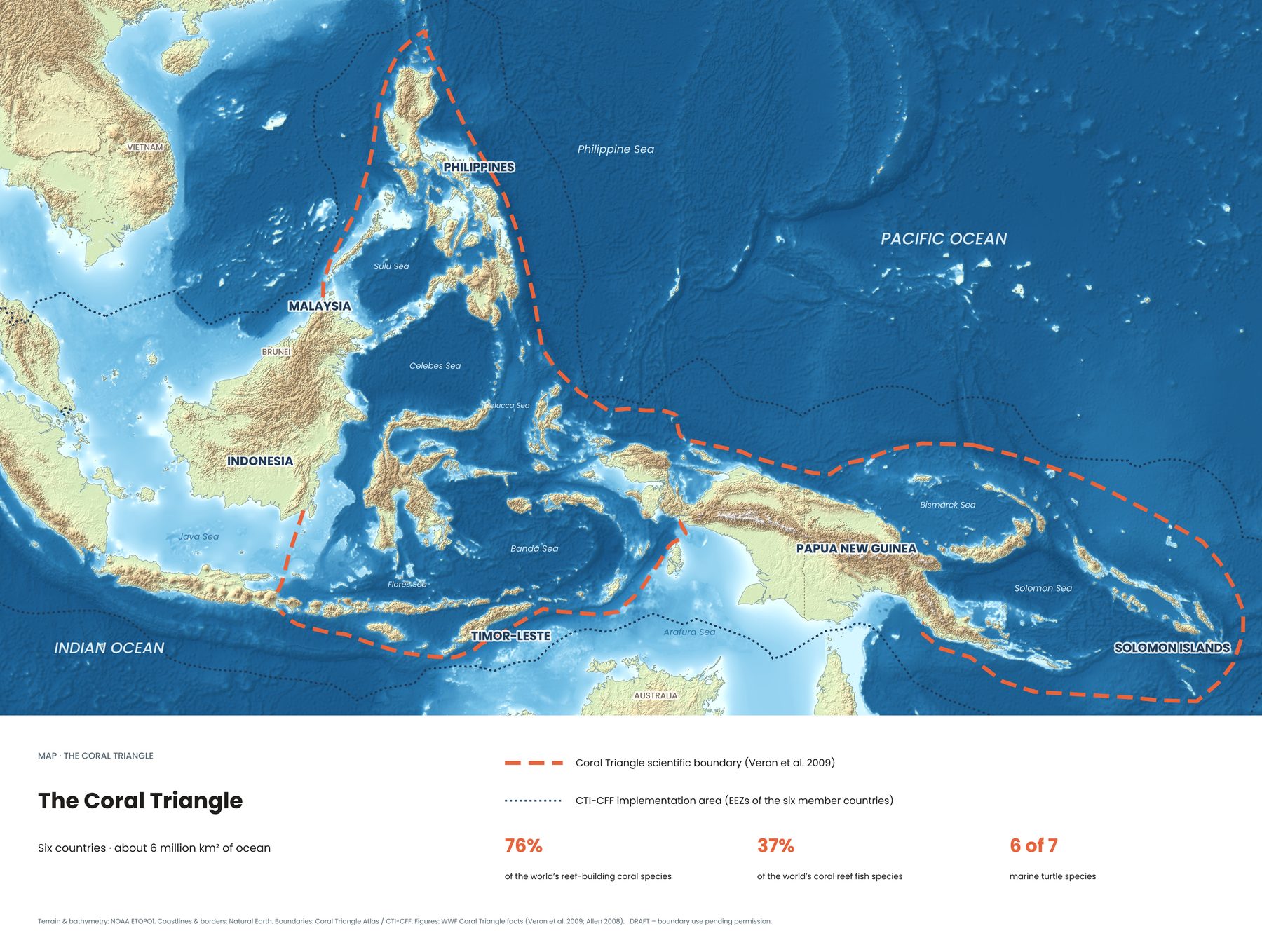
The Coral Triangle covers about six million square kilometres of ocean across Indonesia, Malaysia, the Philippines, Papua New Guinea, Timor-Leste and the Solomon Islands. Its border wasn't drawn by politicians. Marine scientists traced it around the waters where coral diversity is highest, and the six governments now manage it together through the Coral Triangle Initiative (CTI-CFF), founded in 2009.
Six of the world's seven marine turtle species live here. So do whale sharks, manta rays, dugongs and more coral reef fish species than anywhere else.
1. Where the reefs are
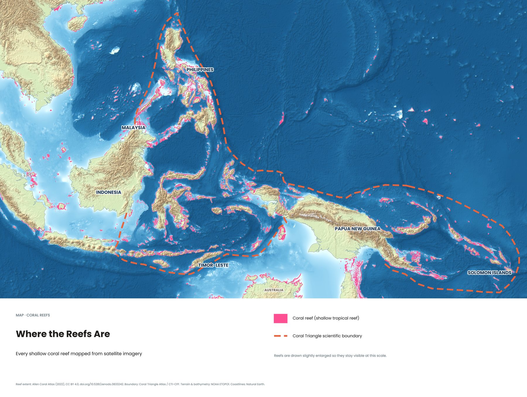
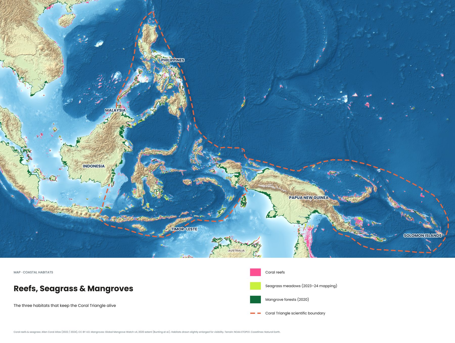
Every pink line on this map is a shallow coral reef, traced from satellite imagery by the Allen Coral Atlas. Look at how the reefs crowd around Sulawesi, the Lesser Sunda Islands from Bali to Timor, and the islands of eastern Indonesia. That's the core of Indonesia's dive country.
2. The current that feeds it all
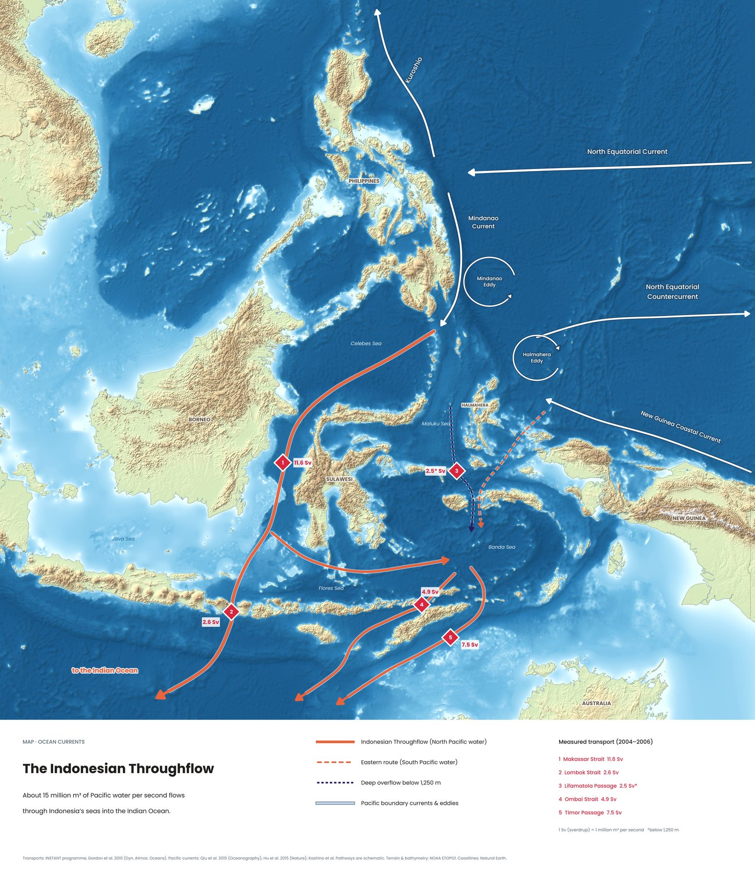
The Coral Triangle exists because of moving water. About 15 million cubic metres of Pacific water per second push through Indonesia's straits on their way to the Indian Ocean. Oceanographers call it the Indonesian Throughflow.
Most of it squeezes through the Makassar Strait between Borneo and Sulawesi. It then exits through three gates: the Lombok Strait next to Bali, the Ombai Strait near Alor, and the Timor Passage. The flow carries nutrients and coral larvae from reef to reef. It's also why dive sites like Nusa Penida, Komodo and Alor have strong currents and sudden cold water.
3. Reefs, seagrass and mangroves
Coral reefs don't work alone. Seagrass meadows are nurseries and feeding grounds for turtles and dugongs. Mangrove forests protect the coast and shelter young fish. Where all three habitats sit side by side, as along the coasts of Papua and Borneo, marine life is at its richest.
4. Clear water and murky water
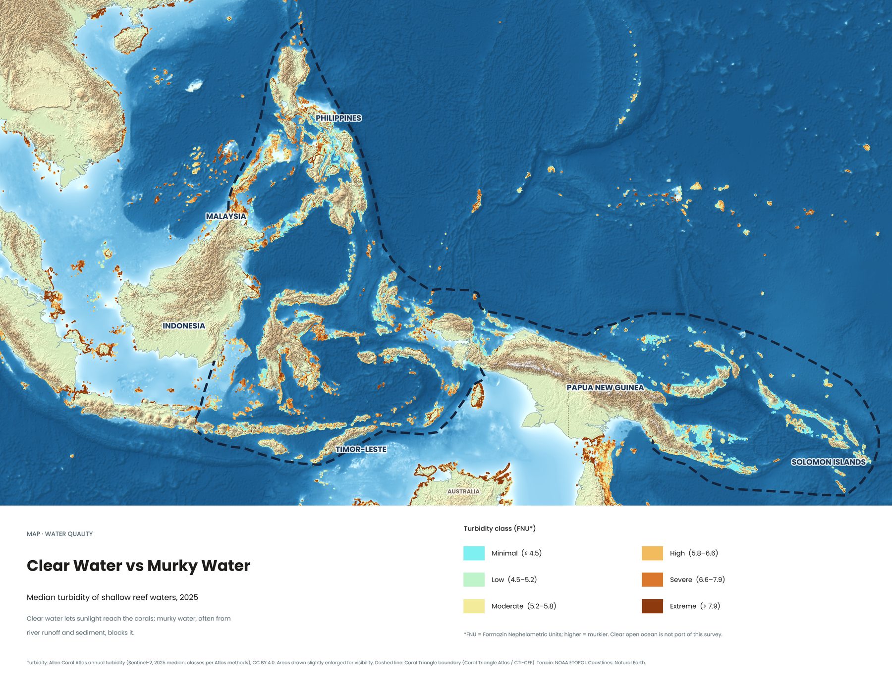
Divers care about visibility, and so do corals: they need sunlight to grow. This map shows how murky the water over each reef was in 2025, measured from space. Brown and orange areas are clouded by river runoff and sediment, often near big rivers and cities. Turquoise reefs, such as those around the Solomon Islands and many remote Indonesian islands, have the clearest water.
5. The 2024 ocean heatwave
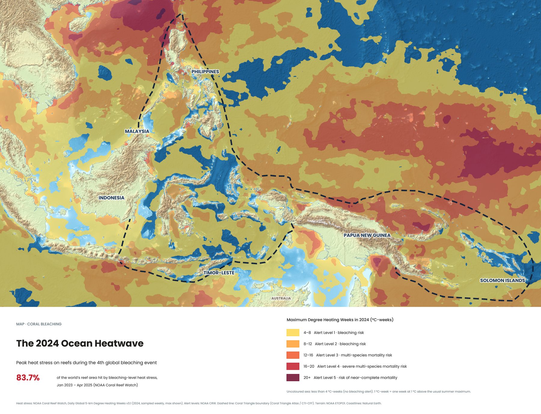
When the sea stays too warm for too long, corals expel the algae that feed them and turn white. This is called bleaching. Between January 2023 and April 2025, NOAA Coral Reef Watch recorded bleaching-level heat stress on 83.7% of the world's reef area, the fourth global bleaching event on record.
The map shows how hard 2024 hit the region. Much of the Pacific side turned red. Parts of central and eastern Indonesia stayed blue, below the bleaching alert level that year.
6. Oil slicks seen from space
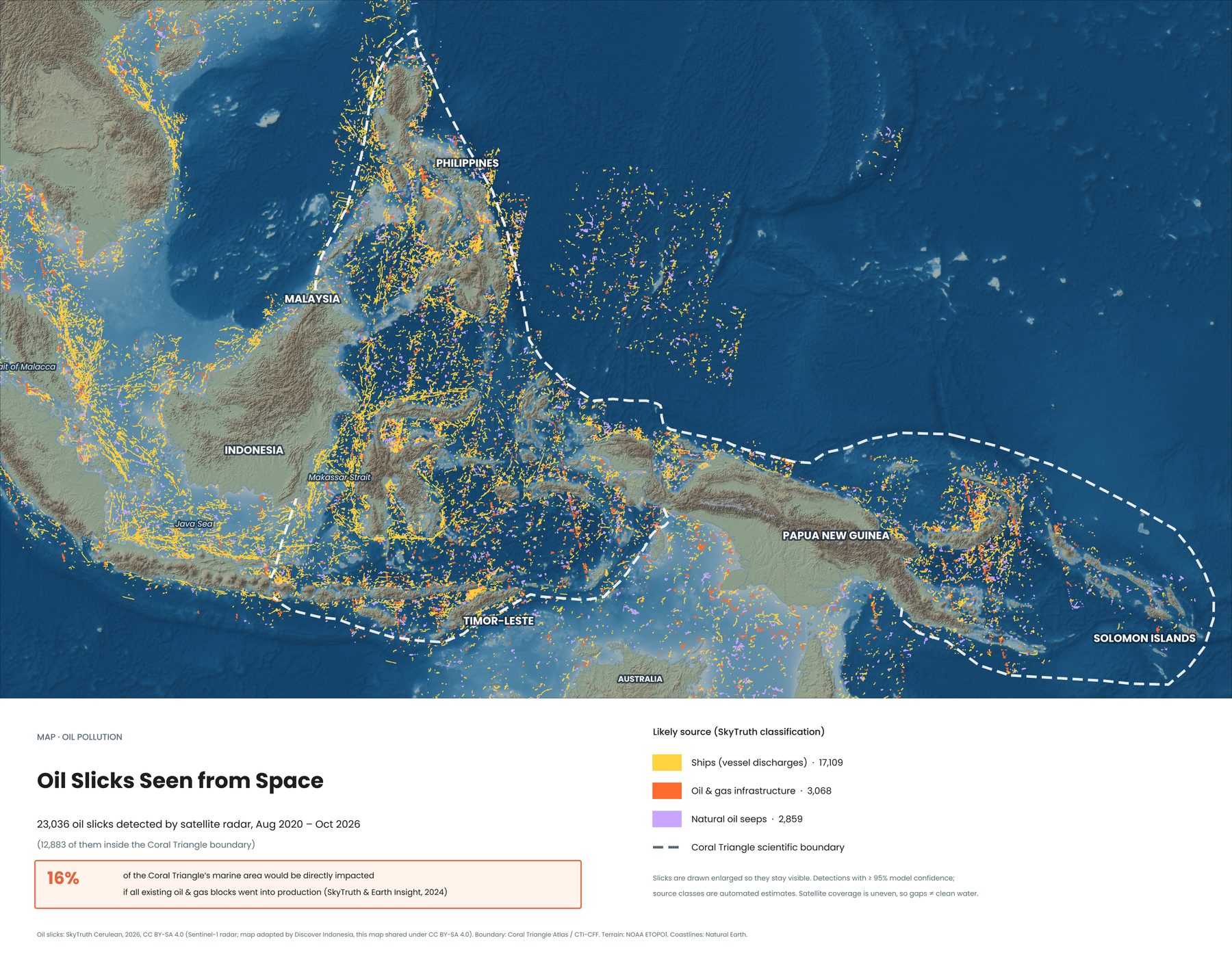
Satellite radar picks up oil on the sea surface. Between August 2020 and October 2026, SkyTruth's Cerulean project detected 23,036 oil slicks in this region, 12,883 of them inside the Coral Triangle. Most came from ships discharging oil at sea. The densest lines follow the busiest shipping lanes, like the Strait of Malacca, the Java Sea and the Makassar Strait.
SkyTruth and Earth Insight also estimate that 16% of the Coral Triangle's marine area would be directly affected if every existing oil and gas block went into production.
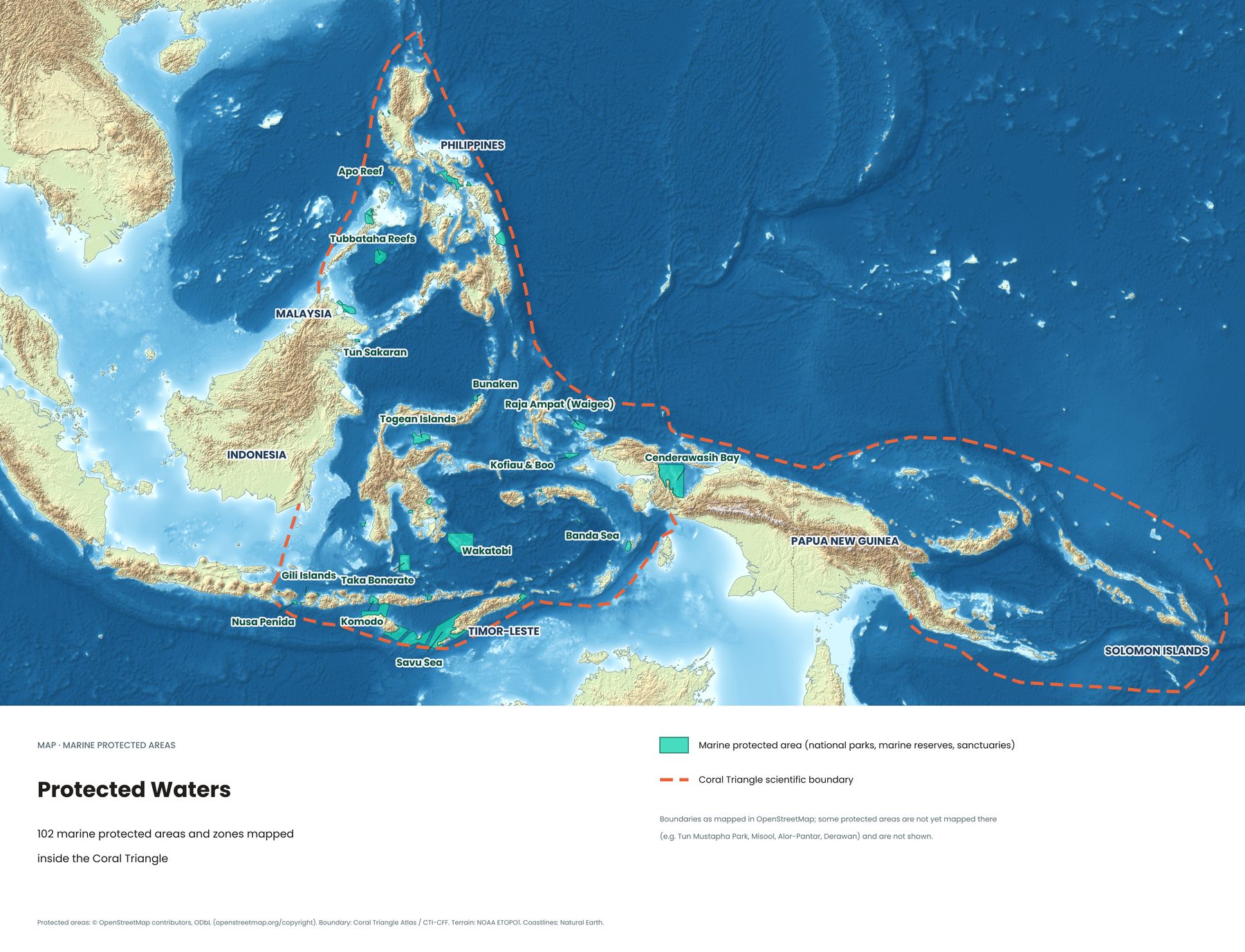
7. The protected waters
There's good news too. Marine parks now cover some of the region's most important reefs, and many of them are well-known dive destinations: Raja Ampat, Komodo, Wakatobi, Bunaken, Taka Bonerate, Nusa Penida, the Gili Islands and Cenderawasih Bay in Indonesia, and Tubbataha and Apo Reef in the Philippines.
Park fees help pay for rangers and patrols. When you dive here, they're money well spent.
Explore each map in depth
- The Indonesian Throughflow: the ocean current behind Indonesia's best dives
- Reefs, seagrass and mangroves: where the habitats are
- Clear water vs. murky water: visibility across the Coral Triangle
- The 2024 ocean heatwave and coral bleaching
- Oil slicks seen from space
- The protected waters: marine parks on one map
Where to see it for yourself
Almost all of eastern Indonesia lies inside the Coral Triangle. Bali's Nusa Penida sits right on its western edge and is the easiest place to start. Further east, you have Komodo's currents, Wakatobi's quiet reefs, Lembeh's strange small creatures and, at the far end, Raja Ampat. See all of Indonesia's dive regions on one map →
How to visit responsibly
- Use reef-safe sunscreen, or cover up with a rash guard.
- Never stand on or touch coral, even where it looks like rock.
- Pay marine park fees. They fund rangers and local communities.
- Choose operators that keep groups small and brief you on reef etiquette.
Frequently asked questions
Is Bali in the Coral Triangle?
Bali sits on the western edge of the scientific boundary. Nusa Penida and the reefs of east and north Bali fall inside it, which makes Bali the easiest entry point.
Do I need to dive to see it?
No. Many reefs in Raja Ampat, Komodo, Wakatobi and the Gili Islands are shallow enough for excellent snorkelling.
Why is the Coral Triangle so rich?
Warm, stable water, thousands of islands that each create different habitats, and the Indonesian Throughflow carrying nutrients and coral larvae between them.
Sources
- Allen Coral Atlas (reef extent, seagrass, turbidity), CC BY 4.0
- Global Mangrove Watch v4 (mangrove extent 2020)
- NOAA Coral Reef Watch (Degree Heating Weeks, global bleaching event figures)
- SkyTruth Cerulean (oil slicks), CC BY-SA 4.0; SkyTruth & Earth Insight (2024)
- INSTANT programme, Gordon et al. 2010 (throughflow transport)
- OpenStreetMap contributors, ODbL (protected areas)
- WWF and CTI-CFF (Coral Triangle facts)