Coral reefs get the attention, but they don't work alone. Behind almost every healthy reef in the Coral Triangle lie seagrass meadows and mangrove forests that feed it, shelter its young fish and protect the coast. These maps show where all three are.
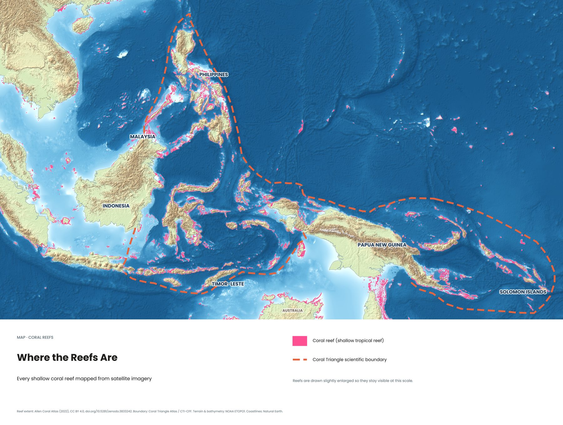
Every shallow reef, mapped from space
The Allen Coral Atlas mapped the world's shallow tropical reefs from satellite imagery. On this map, every pink line is reef. Look at how they crowd around Sulawesi, the Lesser Sunda Islands from Bali to Timor, the Philippines and the islands of Papua New Guinea and the Solomons.
Three habitats that need each other
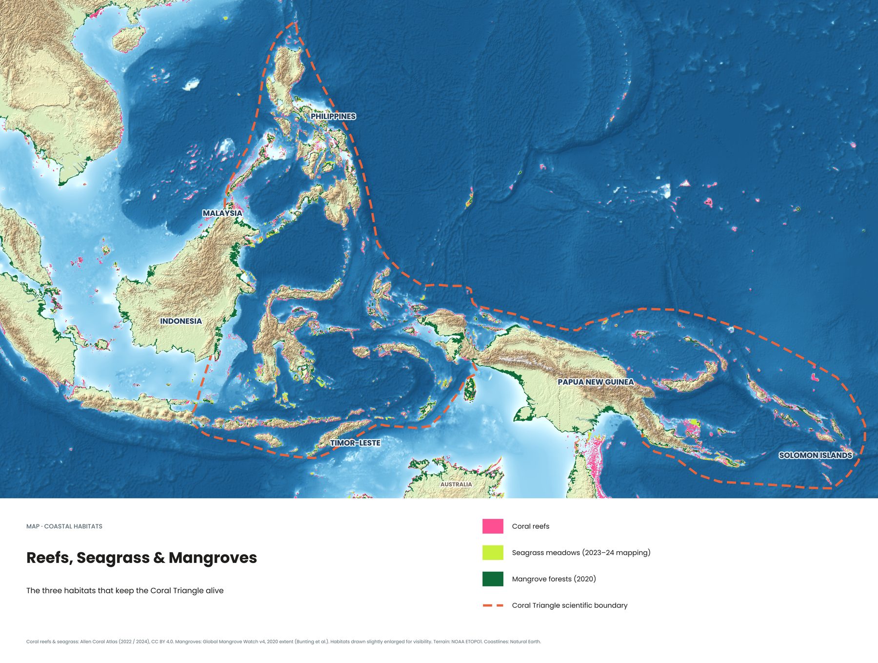
- Coral reefs are the biodiversity hotspots, home to most of the region's fish species and the reason divers come.
- Seagrass meadows are underwater pastures in shallow, sheltered water. Green turtles and dugongs graze here, and many reef fish spend their early life hiding in the grass.
- Mangrove forests grow where the land meets the sea. Their roots trap sediment before it reaches the reef, protect the coast from storms, and act as nurseries for fish.
Where all three sit side by side, as along parts of Papua, Borneo and the Philippines, marine life is at its richest. When one disappears, the others suffer too.
Where to see them
Many of Indonesia's dive regions combine all three. In Raja Ampat, you can snorkel through mangroves with corals growing between the roots. Around the Gili Islands and Komodo, turtles graze on seagrass close to the reefs. See Indonesia's dive regions on one map →
See all eight Coral Triangle maps →
Sources
- Allen Coral Atlas (reef extent 2022; seagrass 2023–24), CC BY 4.0, doi.org/10.5281/zenodo.3833242
- Global Mangrove Watch v4, 2020 extent (Bunting et al.)
- Boundary: Coral Triangle Atlas / CTI-CFF. Terrain: NOAA ETOPO1. Coastlines: Natural Earth