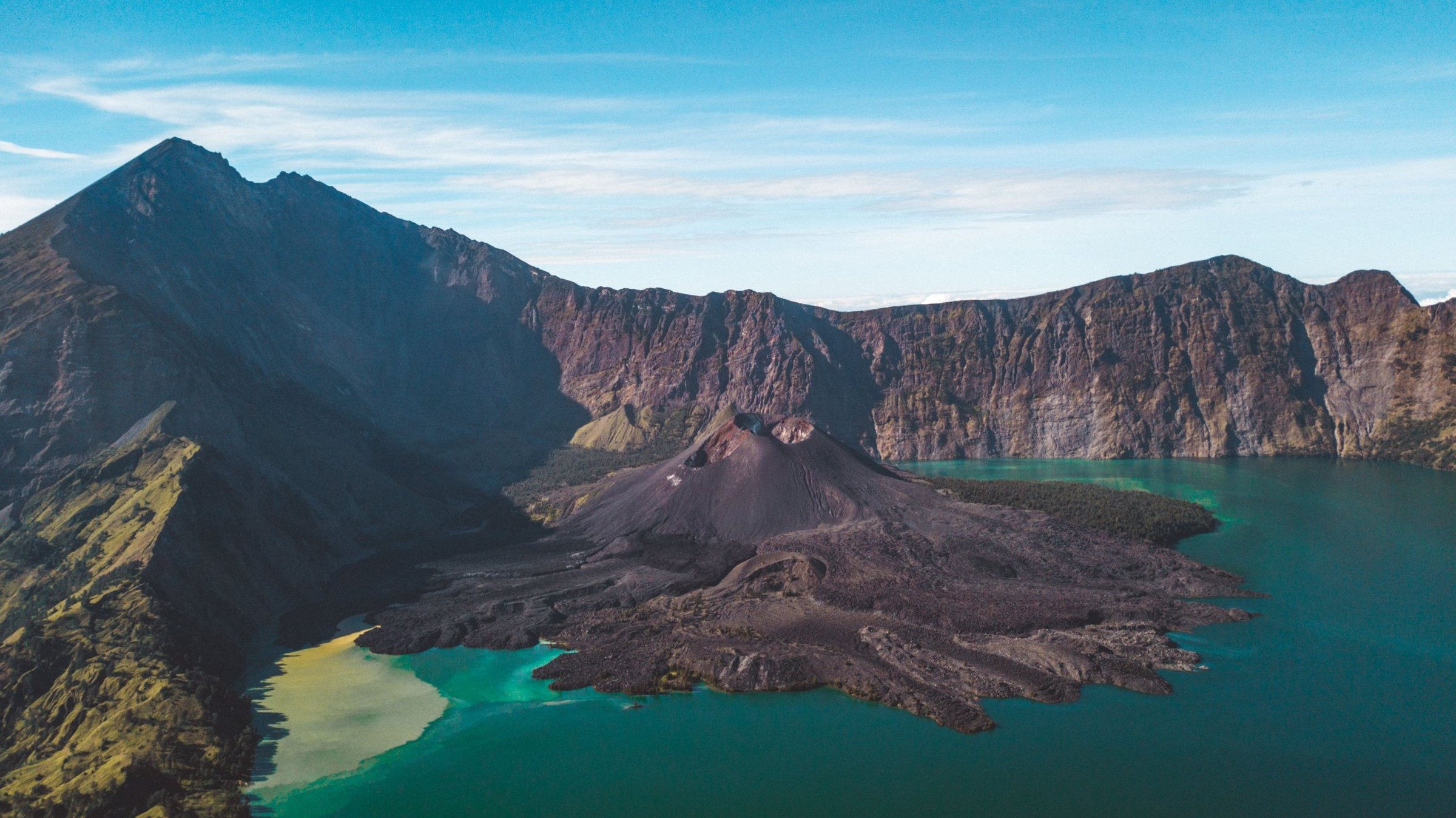
Indonesia's second-highest volcano cradles a crescent lake inside a caldera torn open in 1257. Sacred to the Sasak and to Lombok's Hindus, Rinjani offers a demanding climb from village farmland to a summit above the clouds.
A volcano inside a volcano
Mount Rinjani rises to 3,726 metres in northern Lombok, making it the second-highest volcano in Indonesia after Kerinci on Sumatra. West of the summit lies an oval caldera about 6 by 8.5 kilometres across. Its western half holds Segara Anak, a crater lake roughly 2,000 metres above sea level. The name means "child of the sea", a nod to its deep blue water.
On the eastern side of the caldera stands Gunung Barujari, a young cone whose growth gives the lake its crescent shape. Every eruption recorded since the 1800s has come from Barujari. Eruptions in 2009 and 2015 sent lava into the lake, and an explosion in September 2016 stranded trekkers in the caldera. The Smithsonian's Global Volcanism Program lists 2016 as the most recent eruption.
The eruption of 1257
The caldera is the scar of an older mountain. Samalas once stood beside Rinjani, its summit thought to have reached about 4,200 metres. Sometime between May and October 1257, it erupted in one of the largest volcanic events of the past several thousand years. Its plume rose an estimated 43 kilometres, and it released far more sulphur than Krakatau in 1883 or Tambora in 1815. The mountain's core then collapsed into its emptied magma chamber, leaving the basin that now holds Segara Anak.
Sulphate in ice cores from Greenland and Antarctica pointed to a vast mid-13th-century eruption with no known source. In 2013 a team led by geographer Franck Lavigne identified Samalas, matching traces in the polar ice with deposits on Lombok. The Babad Lombok, an old chronicle written on palm leaves, describes the mountain's collapse and the destruction of Pamatan, the island's capital at the time. Researchers believe the city may still lie buried beneath the ash.
A sacred mountain
For many people on Lombok, Rinjani is the centre of the world, a bridge between heaven and earth, much as Gunung Agung is for Bali. In Sasak belief the mountain is ruled by Dewi Anjani, a queen of the spirit world whose palace is said to lie near the lake. Bayan, in the northern foothills, is the heartland of Wetu Telu, a local form of Islam shaped by older traditions.
Hindus living around Rinjani also hold Segara Anak sacred. Before the rainy season they gather at the lake for Mulang Pekelem, a thanksgiving ceremony and prayer for rain. Offerings, including small figures of gold, silver and copper shaped as fish, shrimp and turtles, are given to the water. The lakeside hot springs are believed to heal.
Trekking Rinjani
Most trekkers start from one of two villages. Sembalun, on the eastern side, sits in a high valley of grassland and leads to the crater rim camp below the summit. Senaru, in the north, climbs through dense tropical forest to a rim overlooking the lake. Smaller official trailheads include Timbanuh, Aik Berik, Tetebatu and Torean.
Organised treks usually last two to four days. A common three-day route reaches the summit on a pre-dawn climb timed for sunrise, then descends to Segara Anak and its hot springs. Two-day summit trips are possible but demanding. The national park closes the trails during the wet season, typically from January to the end of March, to protect walkers and let the ecosystem recover. April to October is generally considered the best period.
Climbing safely
Rinjani is a serious mountain. The summit ridge is steep and exposed to wind, fog can arrive without warning, and night temperatures at the rim can fall to a few degrees above zero. After the July 2018 earthquake, landslides left more than 500 hikers and guides stranded until they were evacuated. In 2025, following several accidents including a fatal fall, the park tightened its rules on certified guides, insurance and health checks. Regulations, weather and volcanic activity all change, so check the current alert level from Indonesia's volcanology agency and the park's latest rules before you go.
