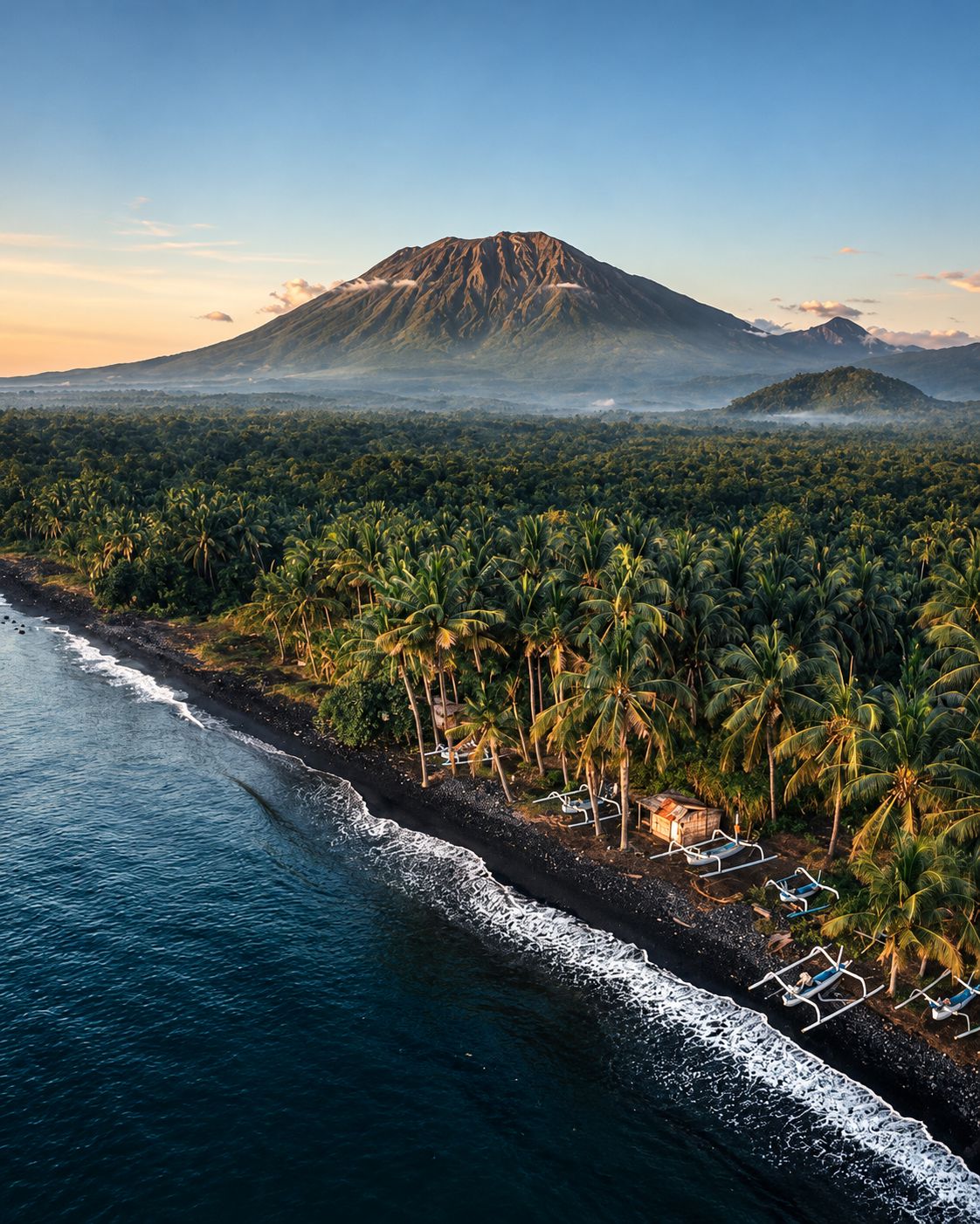
Rising above eastern Bali, Mount Agung is the island's highest point and the spiritual centre of Balinese Hinduism. Its 1963 eruption was among the deadliest of the twentieth century, and it woke again between 2017 and 2019.
The Great Mountain
Gunung Agung means the Great Mountain, and for the Balinese it is far more than a landmark. It is the highest point on the island, a cone that dominates the eastern horizon and often wears a collar of cloud. Balinese Hindus regard it as a replica of Mount Meru, the mythical axis of the universe. One story tells that the gods set the sacred mountain down on Bali to steady the island. Its presence shapes daily life. Shrines across Bali honour its spirit, and many offerings are built in the shape of a mountain.
High on its slopes stands Pura Besakih, the most important temple complex on the island and known as the mother temple of Bali. Its terraced courtyards and tiered shrines climb the hillside toward the summit. For many Balinese, a visit to Besakih is a pilgrimage, and the great ceremonies held there draw worshippers from every corner of the island.
The Eruption of 1963
Agung woke in February 1963 after more than a century of quiet. Lava flowed down the northern flank, and on 17 March a violent explosion sent pyroclastic flows across the slopes to the north and south. A second major explosion followed in May. Heavy rain then turned loose ash into lahars, torrents of mud and boulders that swept through villages below. More than 1,000 people died, and some estimates are considerably higher. The Smithsonian Global Volcanism Program describes it as Indonesia's largest and most destructive eruption of the twentieth century.
The effects reached far beyond Bali. The eruption injected large amounts of sulphur into the stratosphere, where it formed a haze of tiny droplets. Scientists have linked this veil to a small but measurable drop in global average temperatures in the years that followed.
Awakening, 2017 to 2019
In September 2017, a swarm of volcanic earthquakes prompted authorities to raise the alert to its highest level and declare an exclusion zone around the crater. Tens of thousands of people left their homes. The first ash emissions came on 21 November, and within days the activity turned magmatic. Authorities again raised the alert to its highest level and widened the exclusion zone to 10 kilometres.
Ash drifting over the island forced the closure of Bali's Ngurah Rai International Airport in late November 2017. Hundreds of flights were cancelled and thousands of travellers were stranded. Explosions and lava effusion continued intermittently through 2018, with brief disruptions to air traffic. The Smithsonian records the last eruption of this episode in June 2019.
Climbing the Mountain
Two main routes lead up the mountain. The Besakih route starts near the temple complex and climbs to the true summit, the only point with a full panoramic view. It is long and steep, and a round trip usually takes most of a day. The Pasar Agung route starts higher on the southern slope near Selat and ends on the southern crater rim, below the highest point. It is shorter but still demanding.
Most climbers set off around midnight to reach the top before sunrise, before clouds close in over the views. A registered local guide is required, and tourists caught climbing without one have been deported. The mountain closes during major ceremonies at Pura Besakih, often for weeks at a time in spring.
Before You Go
Agung remains an active volcano. Its status is monitored by Indonesia's Centre for Volcanology and Geological Hazard Mitigation, which publishes alert levels and any exclusion zones through its MAGMA Indonesia service. Check the current level before planning a climb. Access rules have also been under review. In 2023, Bali's governor announced a ban on tourist activity on the island's sacred mountains, yet guided climbs have continued since. Confirm the latest regulations and ceremony dates with a licensed guide before you go, carry warm layers and water, and treat the mountain as the sacred place it is.
