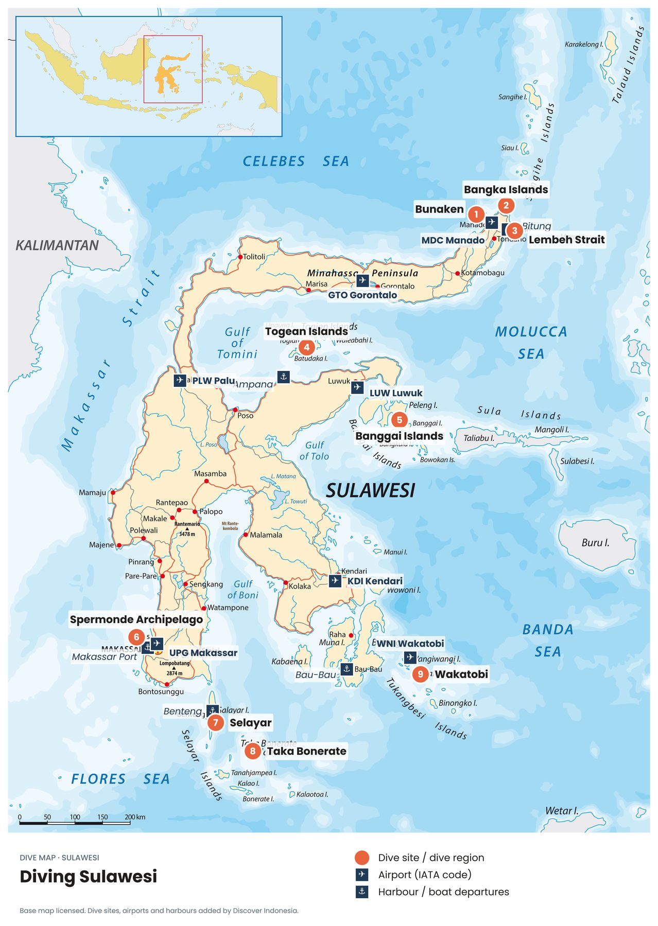
Sulawesi is shaped like no other island, four long arms reaching into four different seas. Each arm has its own diving, from the walls of Bunaken in the north to the atolls of Taka Bonerate and the reefs of Wakatobi in the south.
North Sulawesi
- BunakenCoral walls and turtles in a national park just off Manado.
- Bangka IslandsSoft-coral pinnacles at Sulawesi's northern tip.
- Lembeh StraitThe world's muck-diving capital, near Bitung. North Sulawesi dive guide →
Central Sulawesi
- Togean IslandsRemote islands in the calm Gulf of Tomini, with reefs, lagoons and simple beach bungalows. Reached via Ampana.
- Banggai IslandsHome of the Banggai cardinalfish, a striking little fish found naturally only around these islands. Luwuk (LUW) is the nearest airport.
South Sulawesi
- Spermonde ArchipelagoDozens of small islands off Makassar, easy to reach on a day trip from the city.
- SelayarA long island south of Sulawesi's southern arm, and the gateway to Taka Bonerate.
- Taka BonerateOne of the largest atolls in the world, in the Flores Sea. Taka Bonerate dive guide →
Southeast Sulawesi
- WakatobiA national park of four islands with some of Indonesia's healthiest reefs. Wakatobi dive guide →
Planning a Sulawesi dive trip
- Pick one end of the island. Manado in the north and Makassar in the south are the main hubs, and travelling overland between them takes days.
- Mix land and sea. Sulawesi is also home to Tana Toraja's highland culture, a long drive north of Makassar and worth a few days.
- Allow buffer time for the remote regions like the Togean Islands, Banggai and Wakatobi, where boats and flights don't always connect.
Sources
- Base map licensed; dive sites, airports and harbours added by Discover Indonesia