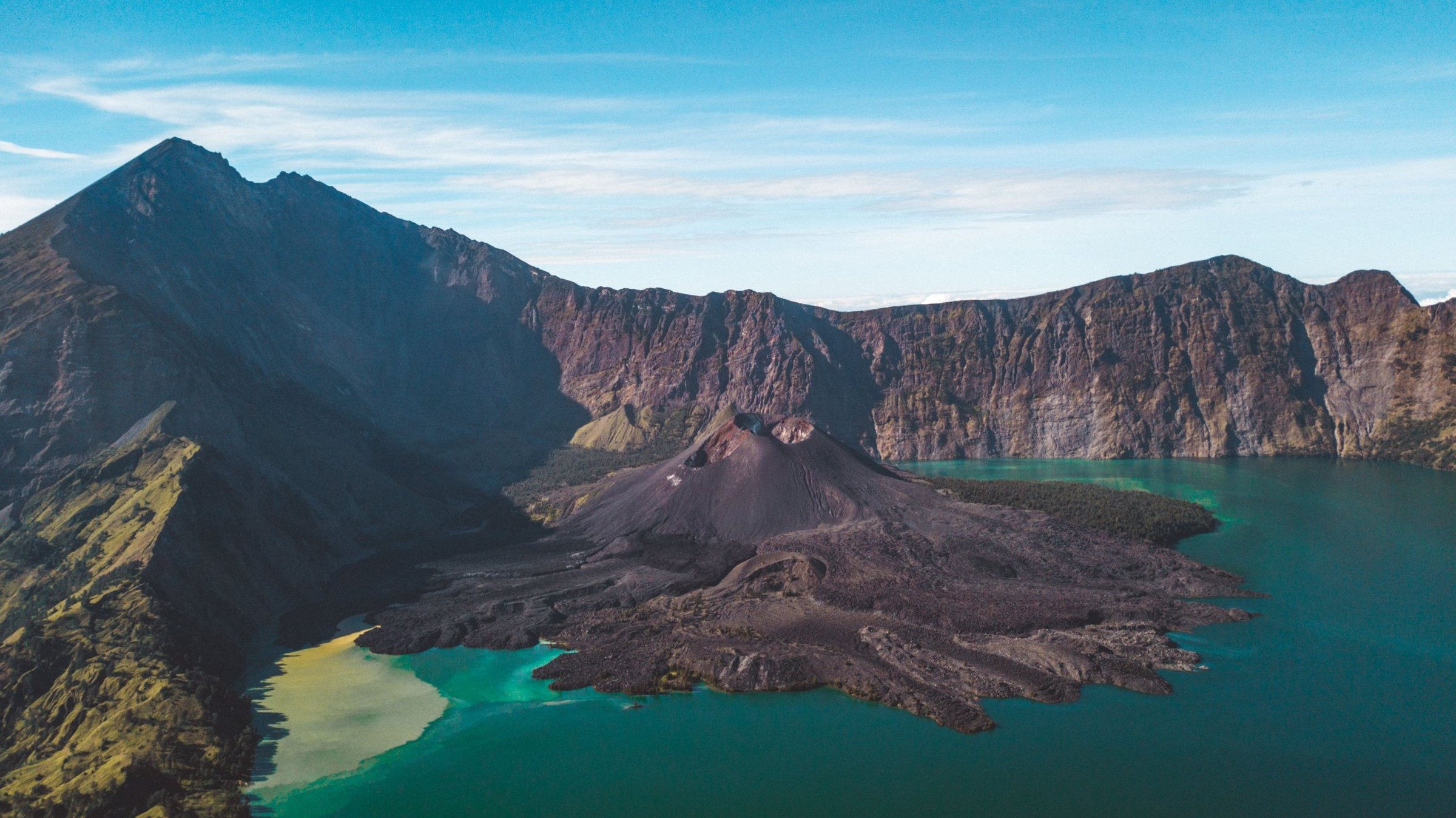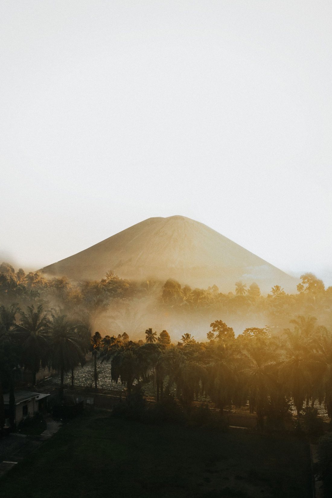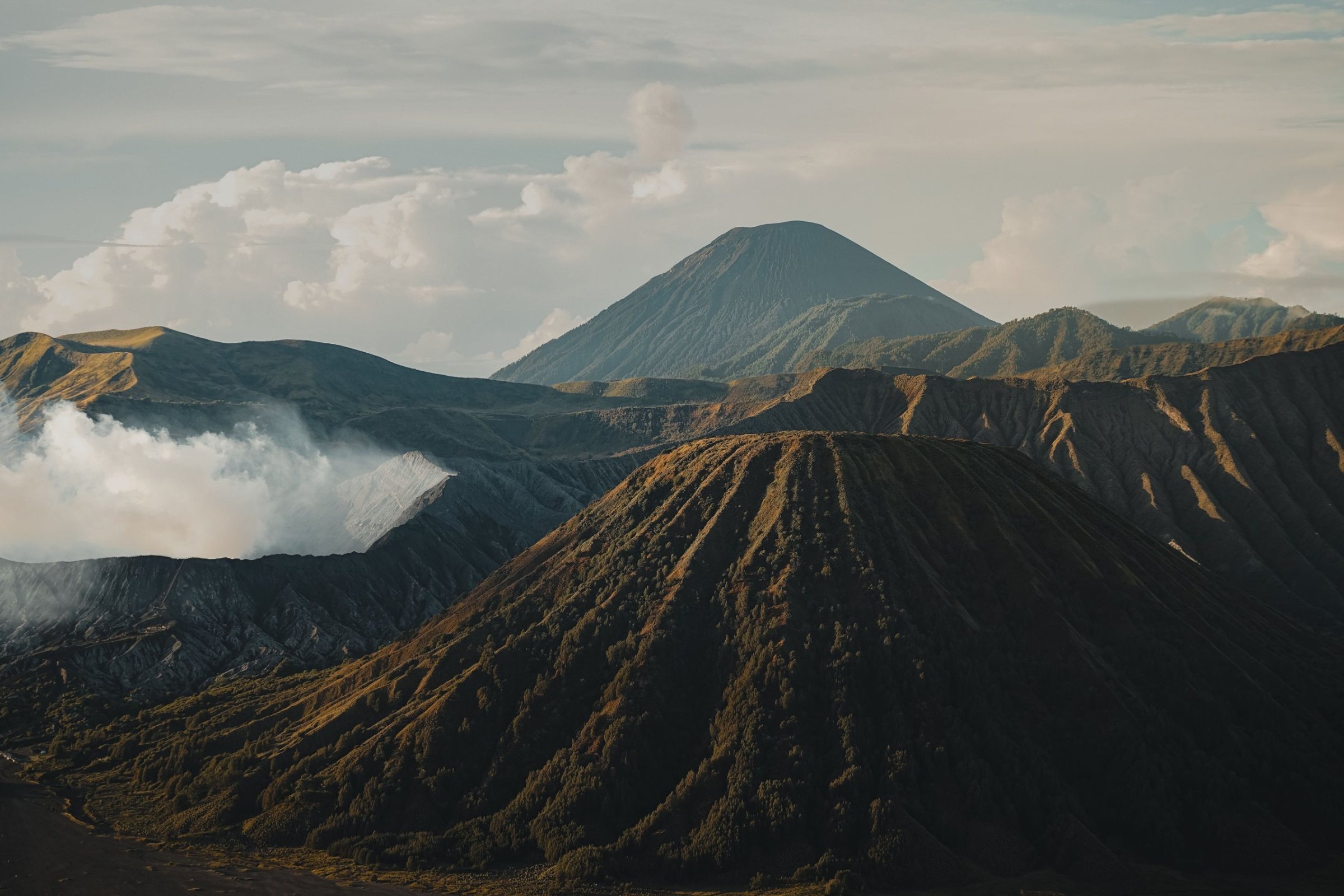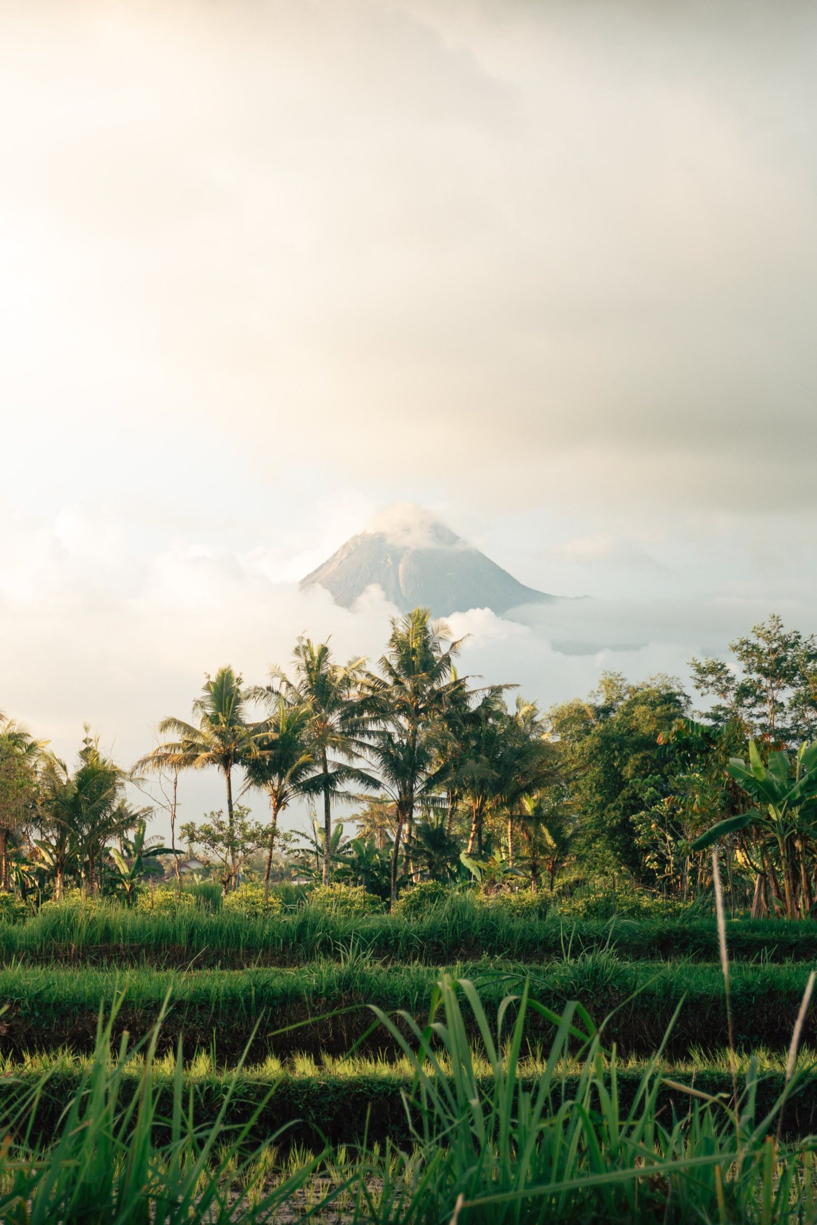
Merapi is the volcano Yogyakarta lives under, and in October 2026 it is still erupting. You cannot climb it, but you can ride an open jeep through the valleys its 2010 eruption buried. Here is how the lava tour works, what you will see, and how to fit it around Borobudur and Prambanan.
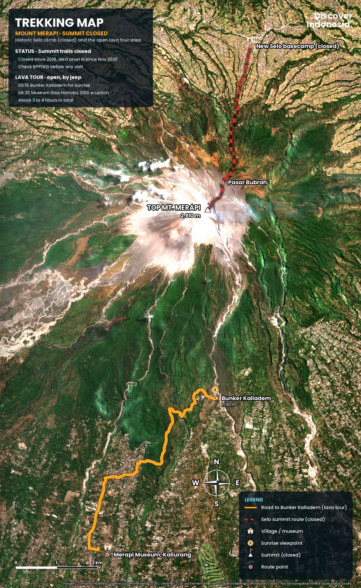
Can you climb Mount Merapi in 2026?
No. As of October 2026 every climbing route on Merapi is closed, and the Mount Merapi National Park office (Balai TNGM) says climbing is not recommended for anyone except disaster-mitigation researchers. The trails have been shut since 22 May 2018, when the alert rose to Level II, and the volcano has been at Level III (Siaga) since 5 November 2020. BPPTKG, the agency that monitors Merapi, confirmed Level III again in its reports of 12 and 17 October 2026.
The mountain is not simply "on alert". It is in an ongoing effusive eruption that began in late December 2020. Two lava domes sit at the top: a southwest dome measured at about 4.18 million cubic metres in an October 2026 drone survey, and a central dome in the summit crater of about 2.37 million cubic metres. The southwest dome sheds glowing lava avalanches most days. In a single week at the end of September 2026, BPPTKG recorded 5 pyroclastic flows reaching up to 2 kilometres and dozens of lava avalanches running down the Boyong, Krasak, Bebeng and Sat/Putih valleys.
In mid-October 2026 the MAGMA Indonesia app briefly showed Merapi at Level I. BPPTKG's head, Agus Budi Santoso, called it human error and confirmed the status was still Level III. Check more than one official channel.
What do the current danger zones mean for visitors?
BPPTKG's recommendation, repeated in its September and October 2026 reports, defines where lava avalanches and pyroclastic flows could reach:
- South to southwest sector: up to 5 km along the Boyong river, and up to 7 km along the Bedog, Krasak and Bebeng rivers.
- Southeast sector: up to 3 km along the Woro river and up to 5 km along the Gendol.
- All around the summit: a 3 km radius, because an explosive eruption could throw incandescent rock that far.
The lava tour operates on the southern and southeastern slopes outside these lines. The zones change as the dome grows and collapses, which is why an operator may skip a stop that was open last month.
What is the Merapi lava tour?
The lava tour is a ride in an open four-wheel-drive jeep across the southern slopes that the 2010 eruption buried. It starts from basecamps around Kaliurang and the Cangkringan district of Sleman, about an hour north of Yogyakarta, and runs on sand and gravel tracks that a normal car cannot handle. Tours last from about 90 minutes to three and a half hours, and each jeep takes up to four adults.
Many of the jeeps are vintage Willys-style machines, and the tour runs through villages that were evacuated or destroyed in 2010. It is part memorial, part geology lesson, part off-road ride.
Which lava tour package should I choose?
Operators sell broadly similar packages, priced per jeep rather than per person. The names and exact stops vary between basecamps, but the pattern published for 2026 looks like this:
| Package | Time | Typical stops |
|---|---|---|
| Short | 1.5 to 2 hours | Museum Sisa Hartaku, Batu Alien, Kali Kuning river |
| Medium | 2 to 2.5 hours | Short route plus Bunker Kaliadem and Mbah Maridjan's former home |
| Long | 3 to 3.5 hours | Medium route plus Mbah Maridjan's grave and a hilltop viewpoint |
| Sunrise | Departs around 04:30 | Bunker Kaliadem at first light, then the usual stops |
The medium route is the sensible minimum, because it adds Kaliadem and Kinahrejo, the two places that explain what happened. The sunrise departure is the best value for photography, since the summit is usually clearest at dawn. Book it ahead on holiday weekends, when local demand is heavy.
What will I see on the lava tour?
You will see the deposits of the 2010 pyroclastic flows, the ruins and relics of villages they destroyed, a bunker that failed in 2006, and, on a clear morning, Merapi's smoking summit a few kilometres away. The stops below are the ones nearly every operator includes.
Bunker Kaliadem
Kaliadem is usually the highest point the jeeps reach, roughly 4 kilometres from the summit, and the village that stood here was destroyed. The concrete-and-steel bunker was built as a refuge from hot clouds. In June 2006 a pyroclastic flow travelling about 7.5 kilometres buried it under hot debris, and two volunteers who had sheltered inside died. Rescuers reported debris near 300°C that melted their shovels; it took them until the second day to open the door. The bunker survives and is now the classic sunrise stop, with Merapi straight ahead.
Mbah Maridjan's house in Kinahrejo
Mbah Maridjan was Merapi's juru kunci, the spiritual gatekeeper appointed by the Yogyakarta palace. He joined the palace staff in 1970 and succeeded his father as guardian in 1982, leading the yearly offerings up the slope. When the eruption began on 26 October 2010 he refused to leave his home in Kinahrejo, about 5 kilometres from the summit. He was found the next day in his burnt house, in a bowing position of prayer, aged 83. Neighbours and family members died with him. His former home is now a small memorial, and the longer tours visit his grave.
Museum Sisa Hartaku
The name means "the remains of my treasures". The museum is a house in Kepuharjo village, Cangkringan, that belonged to a resident named Watinem. Her son Sriyanto gathered what the hot clouds left behind: animal and cow skeletons, the frames of motorbikes, warped televisions and household tools, old photographs, and a half-melted wall clock whose hands show the hour the flow arrived. Entry is free with a donation box, and it is open daily from 08:00 to 17:00. It is the stop that makes the numbers personal, so give it more than five minutes.
Batu Alien
Batu Alien is a large block of volcanic rock carried down in 2010 that, from one angle, looks like a human face in profile. It is a quick photo stop and a lesson in scale: this boulder travelled kilometres from the crater.
Kali Kuning
Most tours end with a run through the Kali Kuning river, where drivers hit the water fast and everyone in the back gets soaked. Channels like this also carry lahars, mudflows of rain-soaked ash, so operators skip them in heavy rain.
What happened in the 2010 eruption?
Merapi's 2010 eruption was its largest since 1872. Scientists raised the alert to the highest level at 18:00 on 25 October, the eruption began at 17:02 the next day, and the strongest explosions came on the night of 4 to 5 November. It killed 386 people according to the final count by the disaster agency BNPB (early tallies of around 340 to 350 are often still quoted), nearly 350,000 were evacuated, and more than 2,000 homes were destroyed.
The exclusion zone grew in stages: 10 kilometres at first, 15 kilometres on 3 November, then 20 kilometres early on 5 November, hours before pyroclastic flows swept further down the southern valleys than anyone alive had seen. A USGS-backed study credits the forecasts by Indonesian scientists and civil authorities with saving more than 10,000 and possibly more than 20,000 lives. The 5 November flows struck Bronggang hamlet in Argomulyo village, Cangkringan, about 13 kilometres southeast of the crater.
The eruption reached well beyond the slopes. Airports closed, hundreds of international flights were cancelled, and losses were estimated at US$781 million. UNESCO notes that ash from 2010 settled on Borobudur, whose acidic deposits are a continuing conservation concern.
How was the 2006 eruption different?
The 2006 eruption was smaller but set the stage for 2010. In June 2006 the Geger Boyo lava dome collapsed and sent hot clouds about 4 kilometres southeast toward the Gendol river; around ten days later a larger flow ran about 7.5 kilometres and buried the Kaliadem bunker. Geologists have linked the collapse of Geger Boyo to the course of the 2010 eruption. The eruption also came within weeks of the 27 May 2006 earthquake that devastated the Yogyakarta region and damaged Prambanan.
Is the Merapi Museum worth visiting?
Yes, especially before the jeep tour. The Museum Gunungapi Merapi, on Jalan Boyong in Hargobinangun, Pakem, around kilometre 22 of Jalan Kaliurang, explains the volcano's geology, its eruption history and how it is monitored. It was inaugurated on 1 October 2009, on a 3.5-hectare site with a main building of 4,470 square metres shaped like a cone.
Inside are volcanic rock samples, eruption photographs, an eruption simulation, interactive displays and everyday objects from slope villages, including a motorcycle wrecked at the Kaliadem bunker in 2006. Recent listings give hours of about 08:00 to 15:00 from Tuesday to Sunday, with an earlier close on Fridays, so plan on it being shut on Mondays and confirm locally. Allow an hour.
Where can I see Merapi without going on a jeep?
The best viewpoint is Ketep Pass, at about 1,200 metres in Ketep village, Sawangan district, Magelang, in the saddle between Merapi and its quieter neighbour Merbabu. On a clear morning the Panca Arga viewing post looks onto Merapi's summit and across to Merbabu, Sindoro, Sumbing and Slamet. Ketep also has a small volcano museum and the Ketep Volcano Theatre, which screens a short film on Merapi's eruptions. It is open daily from 08:00 to 17:00.
Ketep sits on the Magelang side, so it fits naturally between Borobudur and the road toward Boyolali. Go early or late in the afternoon: by midday the summit is usually wrapped in cloud. For gentle walks on the lower slopes, the national park points visitors to the Kalitalang nature area, about 3.3 kilometres from the last post of the old climbing route and outside the danger radius.
What was the Selo climb like?
Before 2018, Merapi was one of Java's classic night climbs. Hikers started at the New Selo basecamp, at about 1,700 metres on the north side in Boyolali, and climbed past Pos 1 and Pos 2 to Pasar Bubrah, a boulder field and campsite at roughly 2,650 metres below the summit cone. The round trip took about 7 to 9 hours.
Even before the current closure, authorities discouraged hiking beyond Pasar Bubrah from 2015. Today TNGM says the entire Selo route lies inside the danger zone: Pos 1 is about 2.3 kilometres from the summit, Pos 2 about 1.64 kilometres, and Pasar Bubrah only about 0.7 kilometres. In July 2026 a rumour that villagers had reopened the route drew crowds of illegal climbers, and the park's head, Heri Wibowo, warned that rangers remain at Selo and the closure stands. Do not join an operator offering a "quiet" Selo climb. If you want a summit, Merbabu is the usual alternative when its own trails are open; check its rules first.
How do I combine Merapi with Borobudur and Prambanan?
Most people do Merapi as a sunrise jeep tour, then Borobudur or Prambanan the same day. Both temple compounds have been UNESCO World Heritage sites since 1991. Borobudur, the 8th to 9th-century Buddhist monument, lies about 40 kilometres northwest of Yogyakarta in the Kedu valley. Prambanan, the great Hindu compound, sits on the border of Yogyakarta and Central Java, northeast of the city.
A sample day
- 03:30: leave Yogyakarta and drive north on Jalan Kaliurang, about an hour.
- 04:30: board the jeep at a Kaliurang or Cangkringan basecamp.
- 05:30: sunrise at Bunker Kaliadem, then Kinahrejo, Sisa Hartaku, Batu Alien and Kali Kuning.
- 08:00 to 09:30: the Merapi Museum, if it is not a Monday.
- Afternoon: Prambanan for the late light, which is the simpler drive from Cangkringan; or keep Borobudur for a separate morning with Ketep Pass on the way back.
When is the best time to do the Merapi lava tour?
Go at dawn, in the dry season. Skies over the summit are usually clearest from first light until about 10:00, and the bare lava fields become hot and hazy around midday. The drier months, roughly May to September, give the best odds of a clear summit and dusty but safe tracks.
In the rainy season, roughly November to March, the tour still runs, but the mountain is often hidden, the tracks turn to mud, and rain can trigger lahars in the river channels. Follow your driver's call if a river stop is skipped. Whatever the month, Merapi's activity, not the weather, decides what is open.
How do I get to Merapi from Yogyakarta?
Fly into Yogyakarta International Airport (YIA) in Kulon Progo, west of the city, or arrive by train from Jakarta, Bandung or Surabaya. The lava tour basecamps are about an hour's drive north of the city via Jalan Kaliurang, and there is no public transport to the tour sites.
The simplest option is a jeep package with hotel pick-up, or a hired car and driver to the basecamp, where you switch to a jeep. You can also stay on the slopes. Kaliurang is an old hill resort with cooler nights and modest guesthouses, and it cuts the pre-dawn drive to minutes. Staying in the city, around the Kraton or Prawirotaman, makes more sense if you are also visiting the temples and want food and nightlife.
Is the Merapi lava tour safe?
It is reasonably safe with a licensed operator who follows BPPTKG's danger zones, but it is not risk-free: you are on an active volcano. Operators work outside the recommended exclusion lines and close stops when activity shifts. The bigger everyday risks are the ride itself and the river crossing.
- Check the status the day before: look at BPPTKG's daily report and MAGMA Indonesia, and ask the operator what is open.
- Never cross a barrier or go beyond the jeep's stopping point: the 3 km summit radius and the river-valley zones are off limits.
- Respect lahar warnings: heavy rain upstream can send mudflows down a dry channel with little warning.
- Hold on: the jeeps are open and drivers play up the bumps and splash. Tell yours if you want a gentler ride, especially with children.
- Dress for dust and water: closed shoes, a buff or mask, sunglasses, a light jacket for sunrise, and dry clothes in a waterproof bag for after Kali Kuning.
How do people on the slopes see Merapi?
For many Javanese, Merapi is a kingdom of spirits as well as a volcano. The Yogyakarta Kraton sits on a symbolic north-south line between the mountain and the Southern Ocean, and the palace still sends labuhan offerings up the slope each year. Kinahrejo and the memorials are places of mourning; behave accordingly. Our Mount Merapi volcano page goes deeper into the geology, the wedhus gembel flows and the palace rituals.
Plan your Merapi trip
- Base: Yogyakarta city for temples and food; Kaliurang for an easy sunrise start.
- Time needed: half a day for the lava tour and museum; two days to add Borobudur, Prambanan and Ketep Pass without rushing.
- Book: a medium or sunrise jeep package with a basecamp in Kaliurang or Cangkringan; confirm the stops when you book.
- Check: BPPTKG and MAGMA Indonesia for the alert level, and TNGM for trail and attraction closures.
- Skip: any offer to climb. The summit is closed and the route lies in the danger zone.
Our Discover Indonesia: Mount Merapi and Yogyakarta guides cover routes, itineraries, where to stay and practical planning for the slopes and the temples in more depth, and our Java guide links Merapi with the rest of the island. Browse them all on our guides page.
Facts checked October 2026. Merapi's alert level, danger zones and open tour stops change with the volcano's activity; check BPPTKG, MAGMA Indonesia and the Mount Merapi National Park office (TNGM) before you go, and confirm museum hours locally.
Sources
- Merawat harmoni di kaki Merapi (Antara, citing BNPB data of 12 December 2010)
- Merapi (Smithsonian Global Volcanism Program)
- Thousands saved by accurate eruption forecasts at Mount Merapi (USGS)
- The 2010 explosive eruption of Java's Merapi volcano: a "100-year" event (USGS / Journal of Volcanology and Geothermal Research)
- BPPTKG tegaskan Merapi masih Siaga (Joglo News, October 2026)
- Laporan resmi BPPTKG 17 Oktober 2026 (Radar Jogja)
- Volume kubah barat daya Merapi berkurang (JPNN Jogja, October 2026)
- BPPTKG ungkap aktivitas Merapi sepekan (Disway Jogja, October 2026)
- Merapi luncurkan wedhus gembel 2 km ke Kali Sat (RCTI+, September 2026)
- Viral pendaki padati Merapi via Selo, TNGM: tidak direkomendasikan (RMOL, July 2026)
- Gunung Merapi masih ditutup (Metro TV, July 2026)
- Living precariously on Merapi's slopes (Kompas)
- 2 trapped by Mount Merapi debris found dead (NBC News / Associated Press, 2006)
- The myth surrounding Mt Merapi eruptions (Antara)
- Mbah Maridjan passes away at 83 (NU Online, 2010)
- Exploring the memory of Mount Merapi's eruption at Sisa Hartaku Museum (Yogyakarta Tourism Office)
- Museum Gunungapi Merapi: Merapi Jendela Bumi (Ministry of Energy and Mineral Resources)
- Museum Merapi (Orami)
- Jogja Lava Tour 2026: routes and sunrise tips (Telkomsel)
- Ketep Pass: a complete guide (Telkomsel)
- Gunung Merapi (Gunung Bagging)
- Mount Merapi hike: can you still climb the volcano? (Backindo, 2026)
- Borobudur Temple Compounds (UNESCO)
- Prambanan Temple Compounds (UNESCO)